| Share: |
| Translate this page: |
| Share: |
| Translate this page: |
What is a trip to an ancient island with a rich history, without examining some of the remnants left by its past human inhabitants?
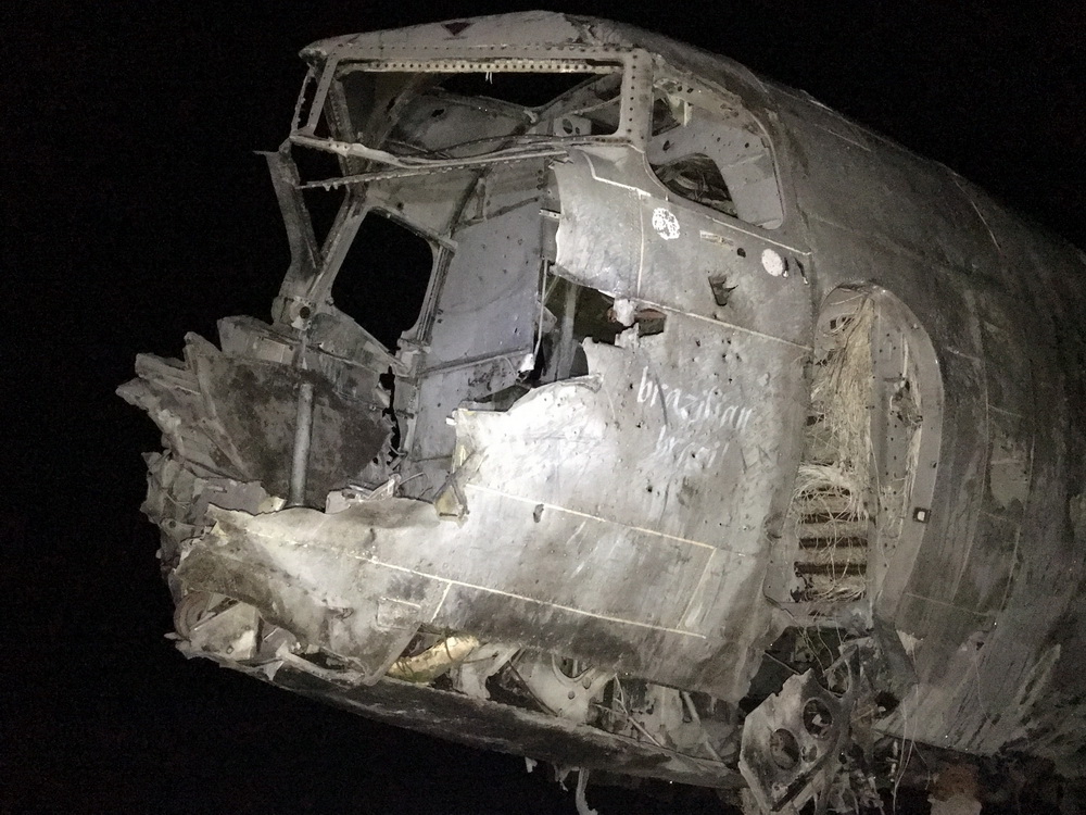
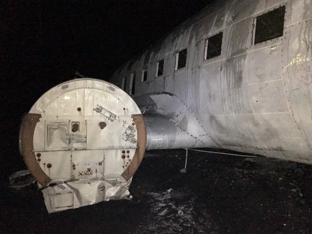
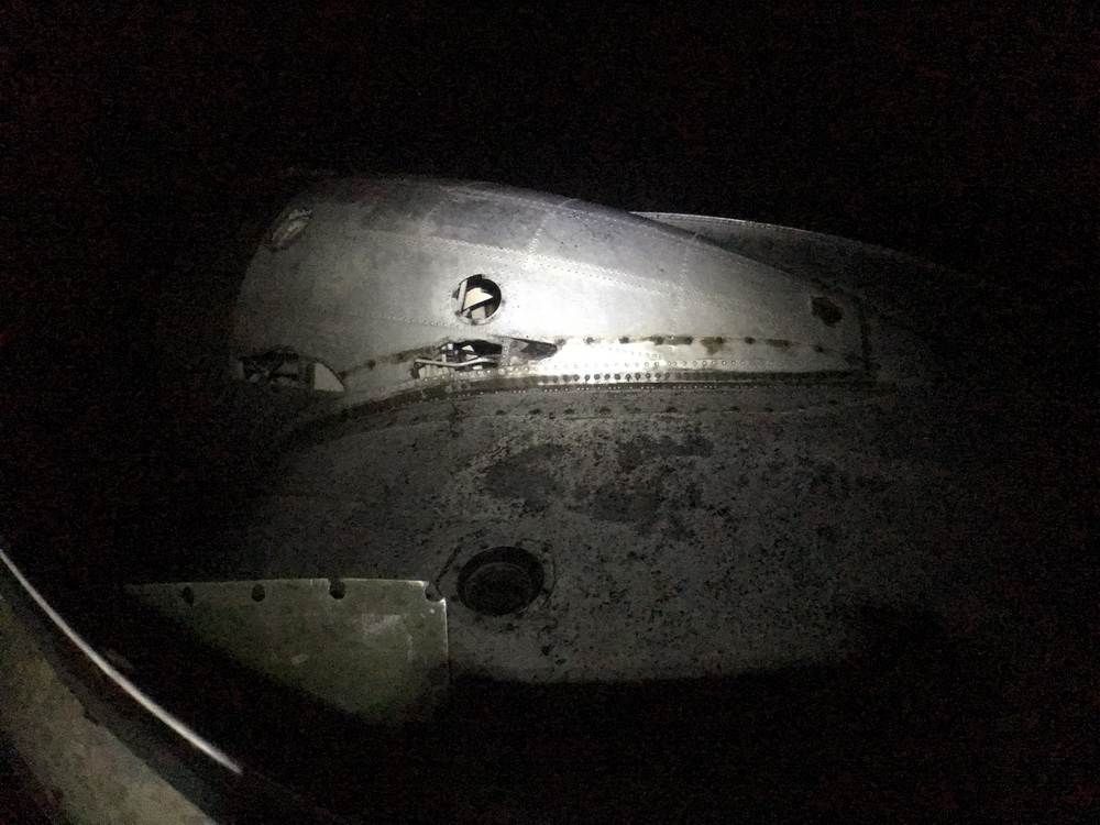
Wednesday, November 21, 1973. A Douglas Super DC-3 of the US Navy enters airspace of Iceland's southern coast, its pilot concerned because he'd switched to the wrong fuel tank - an empty one. The plane was going down. Looking out over the land, there was no option but to attempt as safe a touchdown as possible on the vast stretch of black sand on this glacial outwash plain, Sólheimasandur ('sun home plains'). Skillfully piloting the aircraft in its final minutes, he successfully brought it to a landing, and all the aircraft's passengers were kept safe. A brief hike and short time later they'd be rescued, leaving the aircraft in place, salvaged for some parts but the rest left abandoned on that remote sandy beach.
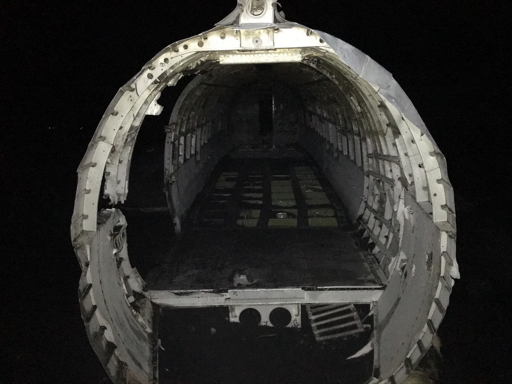
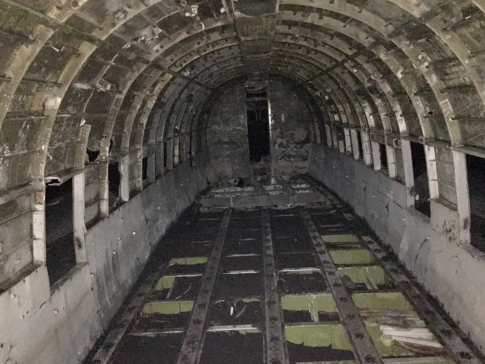
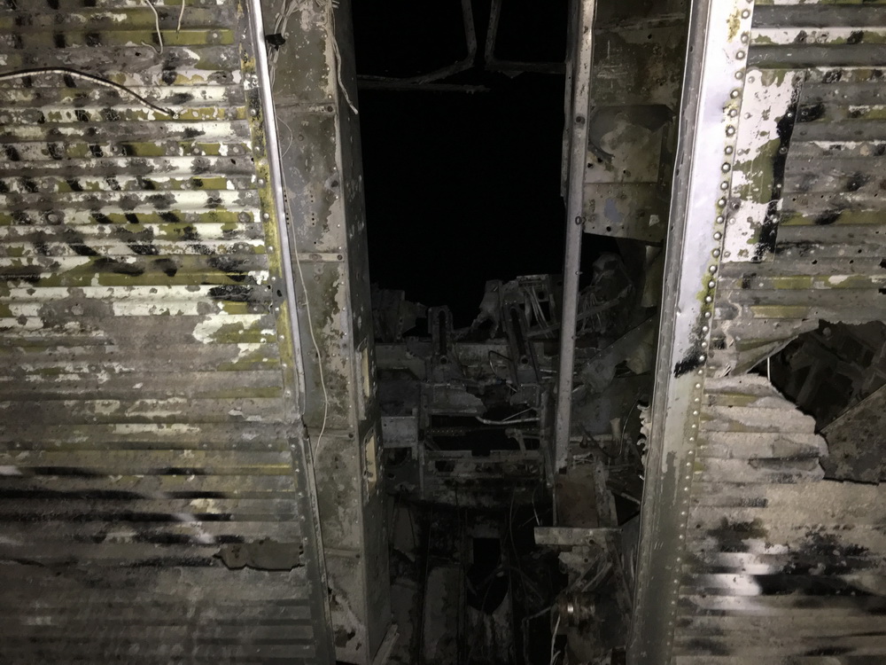
The history of this aircraft is nothing spectacular. But the wreckage remains decades later, torn and ripped, pillaged for parts, and sits as an oddly enticing adventurous location for visitors and tourists to see and touch in person. ... and of course, there is a geocache hidden within.
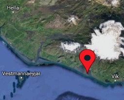
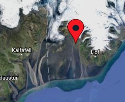
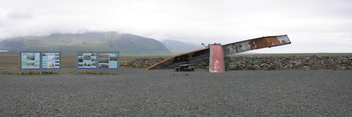
![The location of the US Navy DC-3 on the black sands of Sólheimasandur.<br/>No longer vehicle accessible, it's a 4km hike from the parking area to touch this Navy remnant.<br/><i>[Google Map + OSM]</i>](images/solheimasandur-plane-wreck-dc3.jpg)
Up until recently it was possible to drive (with an appropriate 4x4) up to the wreckage. Landowners have since blocked access due to increased popularity and traffic, asking for the sake of maintaining the land that any visitors proceed on foot from the parking location next to the ring road. The hike is about 4km one way and the route is still marked with reflective posts, but you will certainly want to have a GPS device to help guide you to its location, hidden amongst the wide rolling humps of the expansive beach, day or night.
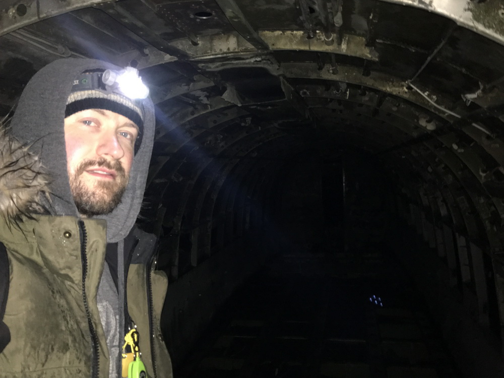
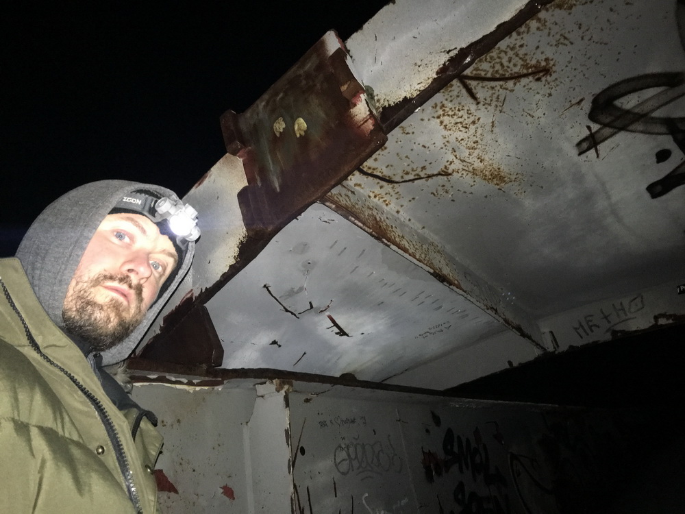
Hrunting and I arrived at parking in the dark of night, and I geared up for the long walk expecting a couple of hours for the round trip. Another vehicle pulled up, and a small group of Asian tourists looked like they were debating whether to set out for the walk. In broken english they asked if I was there to see the plane. We discussed the site for a bit, but they didn't seem as excited to go for an 8km walk in pitch blackness, with a bit of snow starting to fall. They reluctantly held off until the next day, and I bid them farewell.
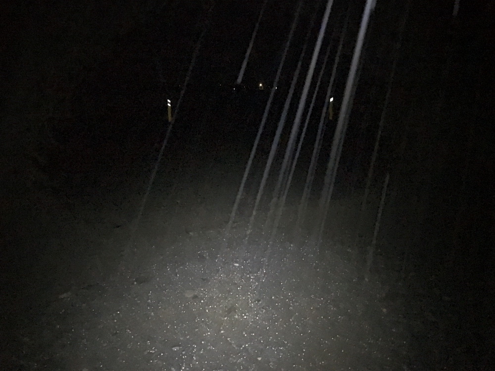
There was barely a hint of blue in the sky as I set out, still able to make out the rough stony route a good distance ahead. But within minutes the night enveloped me and allowed the black sand to become entirely invisible in the darkness. My only respite was my headlamp and a flashlight (with a pocket of batteries). I thought I would be navigating solely by GPS, but with the light shining ahead, the guide posts lit up like a landing strip and gave me comfort; as long as they continued straight, I knew I'd be following the marked route for most of the way.
Hiking for kilometers towards the ocean down a black sand beach in the black of night, following reflective posts like a landing strip. I love Iceland.This late in the day with sunlight fading, visitors to the wreck were all making their way back, and as I was hiking in, I caught the occasional flicker of light from groups coming my way. We'd pass, nod to or greet each other, and continue on, like in good tourist etiquette!
After some time, the reflective posts came to an end, and so I checked my map and location, noticing that I had gone off the GPS-marked trail. Somewhere along the line there must have been a turn off not visible or marked. The beach was vast and black, but bordered by two rivers and the ocean to the south. I reoriented and made a cautious beeline straight towards the wreck's GPS coordinates. A few minutes later, I caught the glint of metal dead ahead.
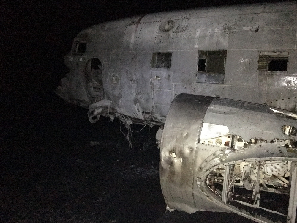
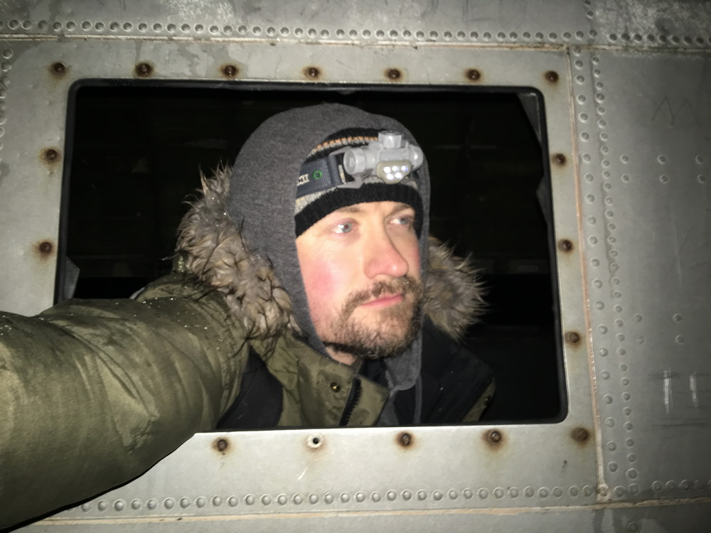
Suffice to say, with no one else around, and seeing no distant lights trailing behind me, I enjoyed some time exploring, climbing, examining, and of course, locating the geocache hidden inside!
The return hike was, for the most part, uneventful; long and cold. I departed the craft and attempted to follow my tracks back to the main trail. After finally spotting the route markers, I was home free.
In the dark, that vast land seems deceptively small. Everything looks much closer than it really is. I watched the distant lights of vehicles occasionally driving along the ring road, far ahead, with the faint glow of small towns and farms tinting the horizon.
It seemed an eternity before two lights that I'd spotted approaching were recognizable as a truck. I wondered if I'd perhaps gone out past an allowed time or if something important or dangerous had happened nearby - but it approached, then continued on past. Likely it was a worker doing a routine check for people who may still be out on the plains. Moments later, I reached for my phone to check my location -- but it was not there. I panicked, realizing that the last time I'd used it was back at the plane. It wasn't in my pockets which I kept checking repeatedly and frantically. I kept patting myself down, wondering if my best option might be to flag down the driver, hoping for a kind and compassionate person who may offer to assist in searching for it. I still couldn't believe this happened.
Then I took a few steps, and suddenly felt a weight near my ankle. It was the phone. I must have slipped it into the pocket of my inner pants for warmth but missed it just enough that it had slipped out into my leg. Which means it could have fallen out at any point during that walk back. I was so glad at that moment for the winter pants with tight ankles!
I thanked God and resumed walking - and soon the truck returned and passed again. It felt like yet another eternity before the glint of the headlamp reflecting on the body of Hrunting appeared. Wide awake now, it was time for a drink and a snack, then off to the next stop!
Translated, "glacier run at spoon river plains" is the event that occurred in 1996, when water in a sub-glacial lake or river (Skeiðará) under the Skeiðarárjökull glacial arm broke free due to the erupting of a volcano near Grímsvötn under the Vatnajökull glacier, lifting and melting through the thick glacial ice. This produced an outburst flow blasting south towards the ocean (the "jökulhlaup").
This enormous flooding reached a peak of 50,000m3 per second, and carried with it gigantic ice chunks and icebergs up to 2000 tons in mass, plus 185 million tons of volcanic sediment. As the flood made its way south, it impacted the ring road, destroying everything in its path, including the 376m Gigjukvisl bridge that spanned the plains here, and damaging other nearby bridges and structures. One remnant of the Gigjukvisl bridge remains, with information plaques explaining the 1996 jökulhlaup.
The 1999 documentary Ice on Fire examines the Vatnajökull glacier and the eruption of the Grímsvötn volcano, leading to the outburst flood. Part 1 is available to be watched online at Vimeo.
You can stop here for a snack if you wish - there is a quaint picnic table to eat at - and imagine the sight of a 4 meter tall glacial tsunami flowing over your head! (and hope that another doesn't occur while you're eating)
After having hiked out to the plane wreck, we pulled up here to gather information needed for the earthcache listed here, educating about this very geological event.
The remains of Gigjukvisl bridge, destroyed by ice boulders in the Jökulhlaup of 1996.Then, not moments after packing up and moving along towards my destination for the night, the skies opened up overhead!
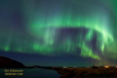
The Aurora Borealis (Northern Lights) is a spectacle to behold. Any trip to Iceland should include a good attempt at witnessing them, if at all possible. The aurora is typically visible in higher arctic and lower antarctic latitudes, where the Earth's magnetosphere draws the solar wind towards the upper atmosphere, causing ionization of particles, and ultimately creating a dramatic dance of curtain-like waves in heavenly hues overhead.
Iceland is well known as an optimal location for viewing them due to its accessibility, northerly and remote location, and very little light pollution from denser civilization. You'll need to visit in the winter to have a chance at seeing the lights, of course, since the black of night constitutes most of the day's hours, providing a long, dark period perfect for sky-watching and stargazing, typically between September and April.
Iceland has a number of resources that help you plan for most optimal viewing times and locations, including a tour that will take you to the best location at the time, and a forecasting website. Weather is a significant factor, since clouds and storms can roll in a matter of minutes obstructing any clear view you may have.
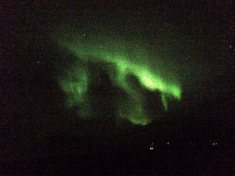
This night, as Hrunting and I were heading to our overnight parking location in preparation for my big mountain hike in the morning, the sky opened up outside the window - clouds disappeared, and faint green hues began to coalesce into visible strips. It happened while driving across wide open flats, with no nearby hills or mountains. Wonderful timing!
Years ago back home, during a reported increase of solar activity, the borealis was expected to appear as far south as my hometown in southern Ontario, so I was excited to just barely make out the blur of green in the lower sky which came frightfully close to disappearing in the glow of the city lights. Tonight though, when I looked out, the unmistakable curtains of green were clearly visible, with even some very subtle hints of blue tinting.
Like an artist's brushstroke weaving to and fro, the waves slowly danced; they grew and fainted in brightness putting me on edge, hoping with each fade that they would return. I had to pull over and find a place to park so I could stop and fully enjoy the show. Themselves, the lights appear fairly bright when contrasted against the black void of the sky, but are actually so faint, emit so little light, that you'll need a higher-end digital camera which is sensitive enough to detect sufficient photos to generate a clear image. I set up my iPhone 6S+, with one of the most advanced smartphone cameras available, to attempt to capture them and even then was only barely able to capture a grainy image which I processed further after taking it. In only one photo of many did I manage to capture with a sufficient exposure one curtain before it blurred into a haze.
The Northern Lights may come out suddenly in full force during a clear moment in the sky. Sadly, this was the best photo I could take with the iPhone 6S+. They are quite difficult to photograph adequately from a vehicle with a smartphone.Suffice to say, a good photo of the northern lights, as much of a challenge and reward it is to capture, simply holds no candle to viewing them with your naked eye. While beautiful, photos which you may see of the aurora borealis just aren't accurate to what the eye sees. On a good night, it is not experience you'll want to miss, and if you visit Iceland in the winter, you really must plan or hope to see them in their glory. If what I saw was a decent night's show, I can't imagine what an active, optimal viewing night might present!
| Waterfalls and sunsets |
Kristinartindar: The Journey is the Reward |
| Missed Opportunities | Geocaching! |
| |||||||||||||