
| Share: |
| Translate this page: |
| Share: |
| Translate this page: |
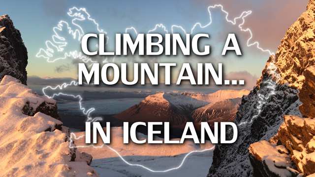
Iceland is home to numerable mountains which are known for hiking trails, climbing excursions, tours, and wondrous views and vistas. One of those such mountains is Kristínartindar, in Vatnajökull Nation Park (or fully named Vatnajökulsþjóðgarður, which translates roughly to 'lake glacier national garden'). That enormous white spot in the lower right middle of Iceland is the mountainous region of the Vatnajökull glacier. It contains numerous mountains, geothermal rivers, volcanoes, and glacial arms of ice stretching down towards the ocean.
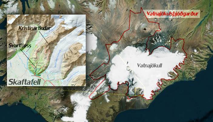
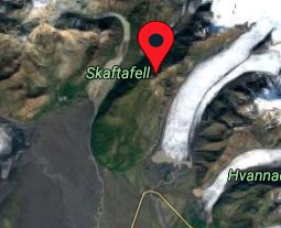
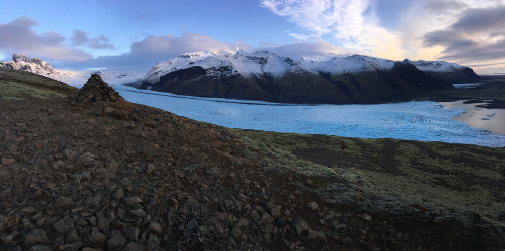
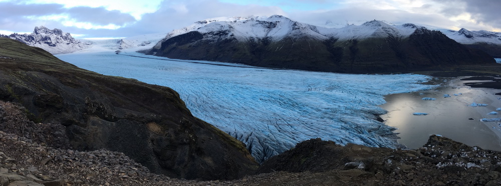
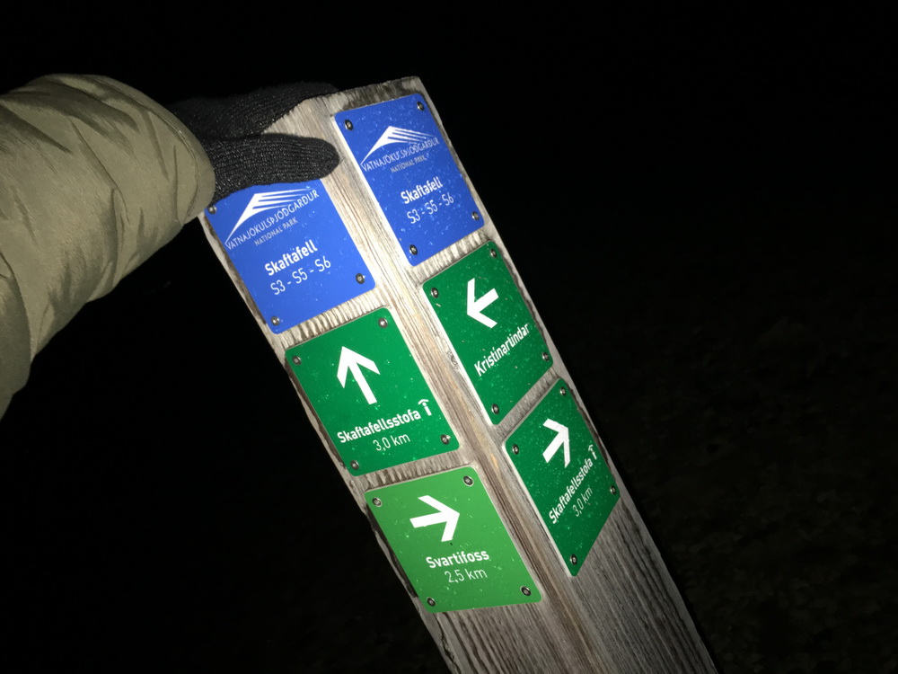
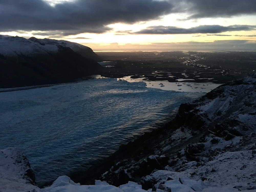
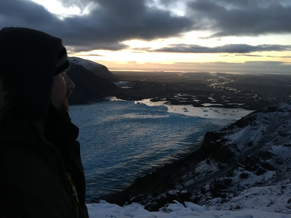
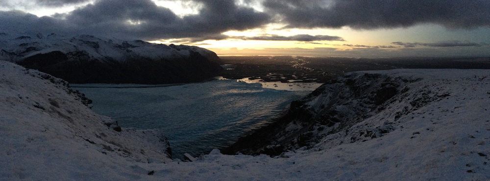
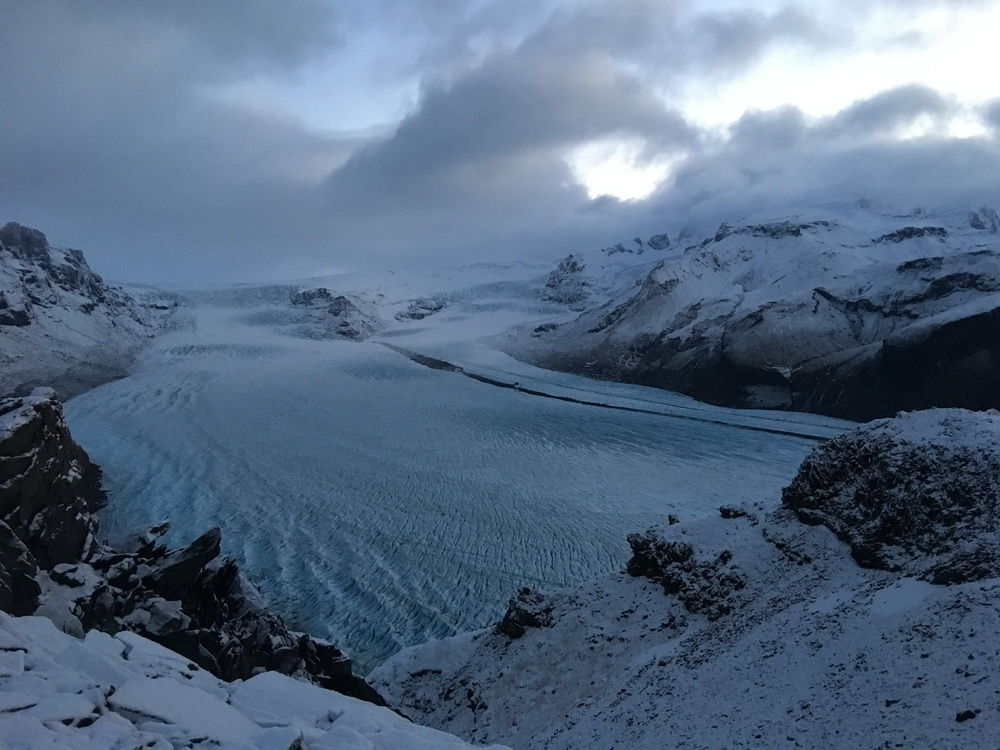
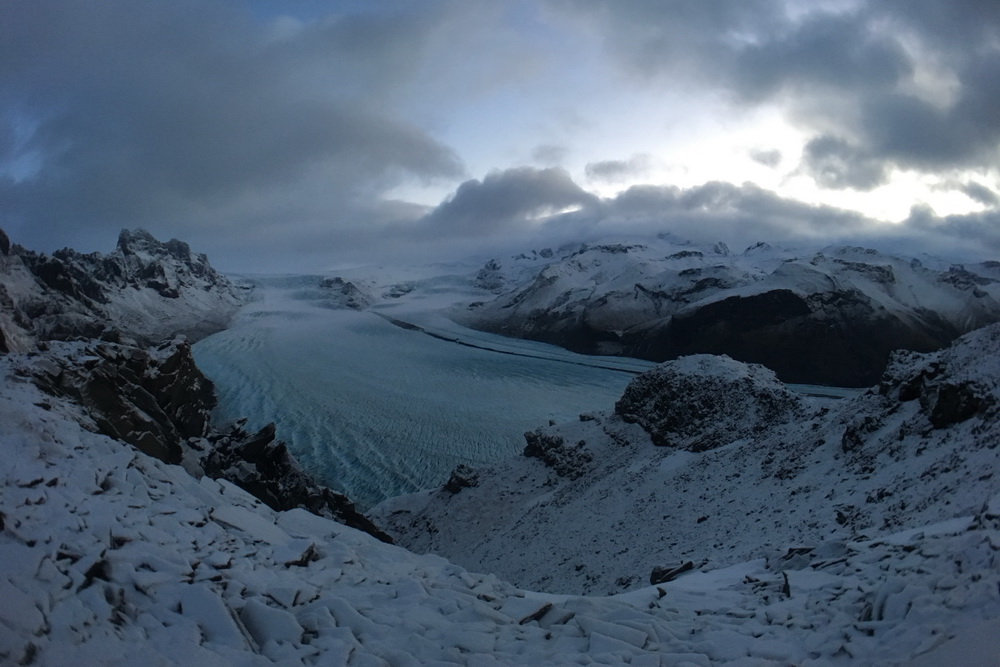
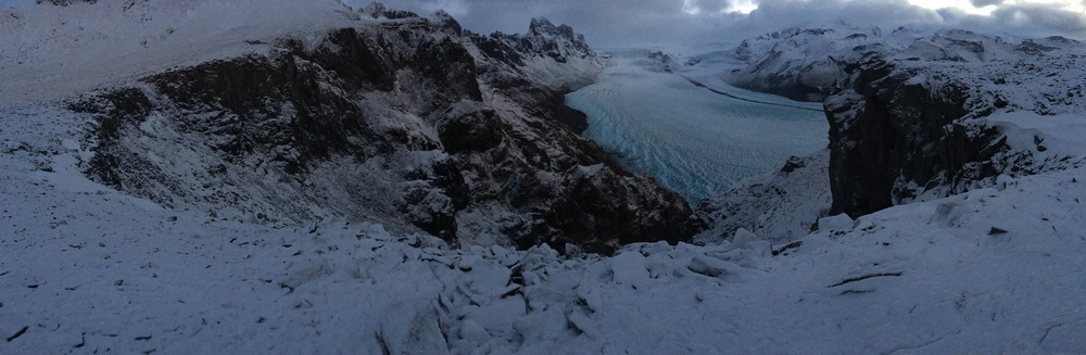
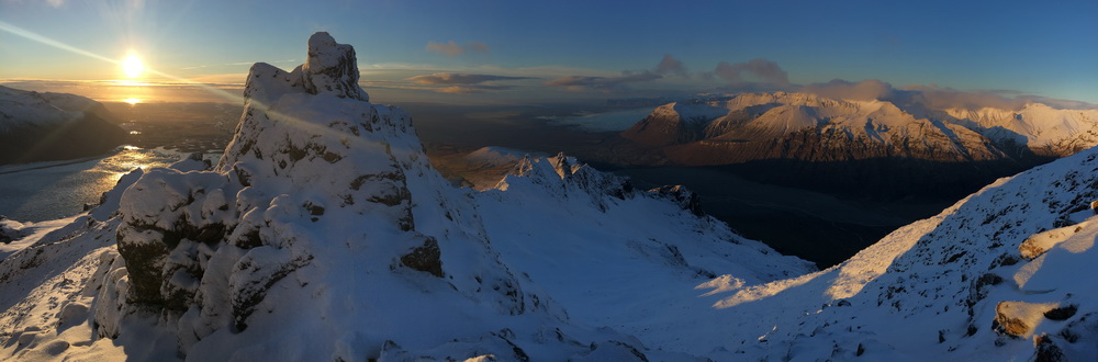
One of those arms is at Skaftafell, a peninsula of land extending out from the greater glacial region. This exposed land is designated as part of the national park, with a number of trails of varying difficulties and terrains. Some routes will take you down alongside the tips of icy fingers - such as Skaftafellsjökull to the east with its crisp blue icy hues and the mountain Hafrafell on its far side, and the retreated Morsárjökull to the west with Skaftafellsfjöll, the range of mountain peaks on its far side. The visitor's center has numerous resources, guides, and maps from which you can plan your visit.
![Svartifoss Waterfall [wikipedia]](photos/svartifoss-wikipedia.jpg)
One popular place to visit is situated at the end of one of the closer trails. Svartifoss ('black falls') is a medium-sized waterfall, but it's recognized by its black basaltic lava columns over which the stream cascades, which are said to have inspired the architecture of Hallgrímskirkja, the Lutheran church in Reykjavik.
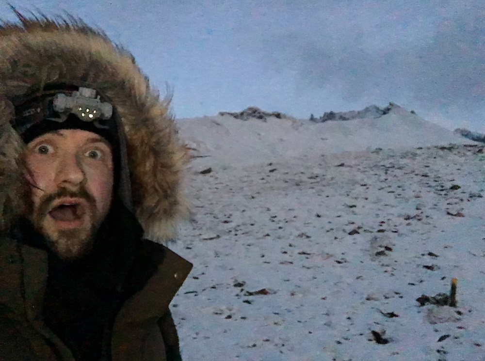
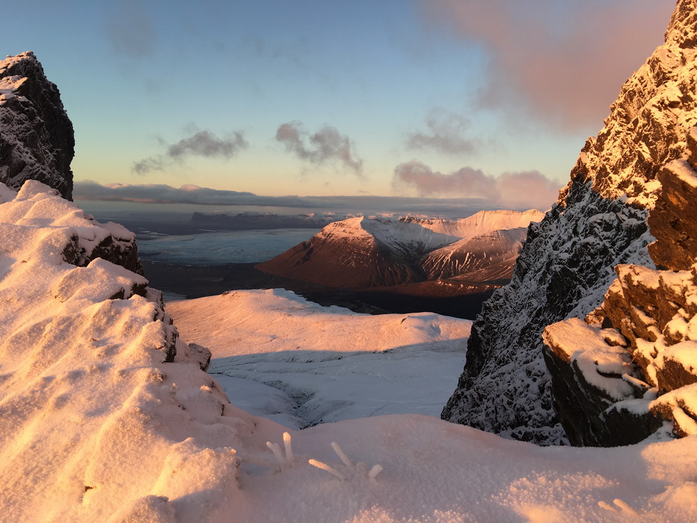
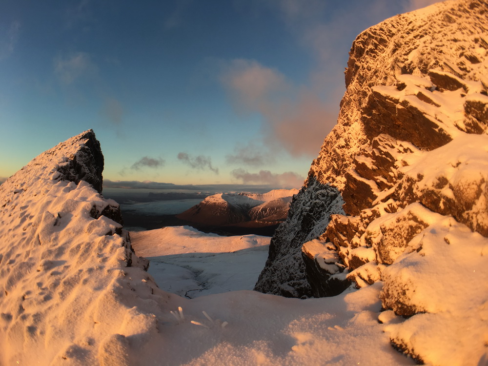
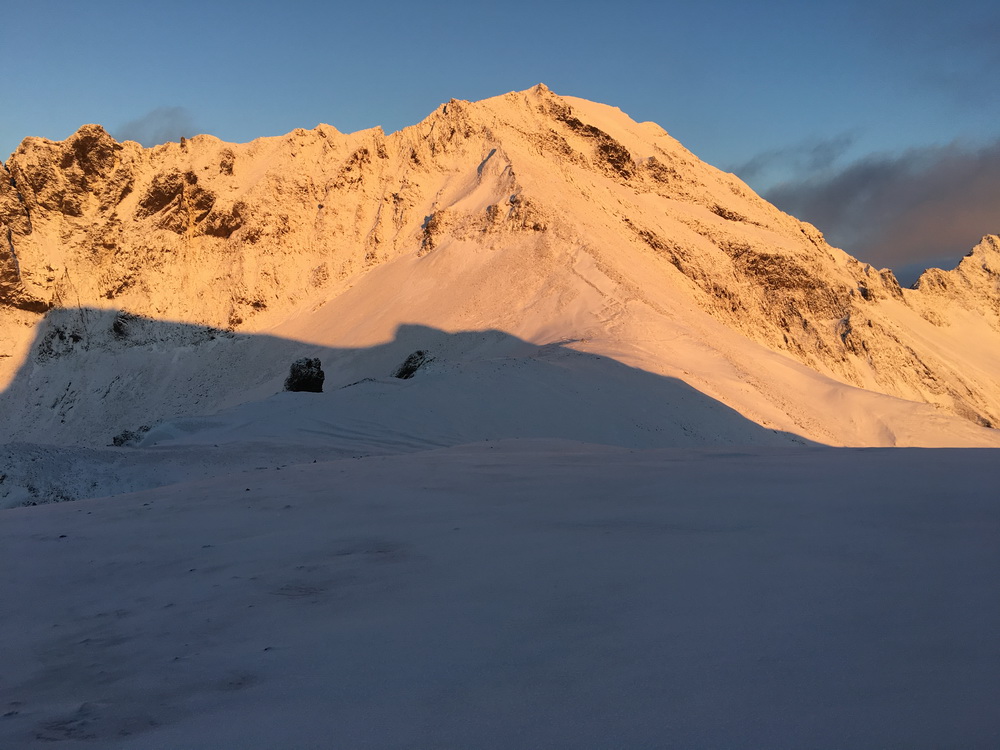
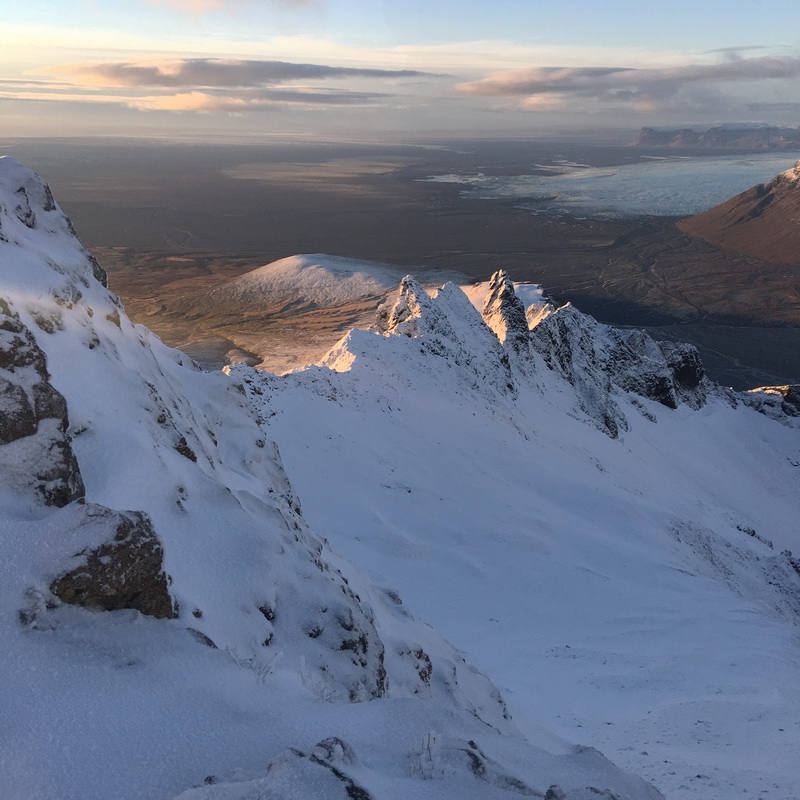
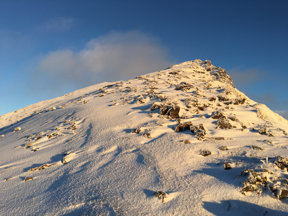
Central to all these hiking destinations, however, is the peak of Kristínartindar. It's actually two peaks, one slightly taller than the other, separated by what people refer to as the 'saddle' - a brief dip between the two peaks. The summit itself has an altitude of 1126 meters (3700 feet), but is actually in a location where during summer months the entire route can be hiked without a hint of snow, while in winter months the snow line descends to cover a majority of the hiking trail. On the free climbing YDS scale, it would be rated a class 2 (some scrambling, use of hands; but no rope needed).
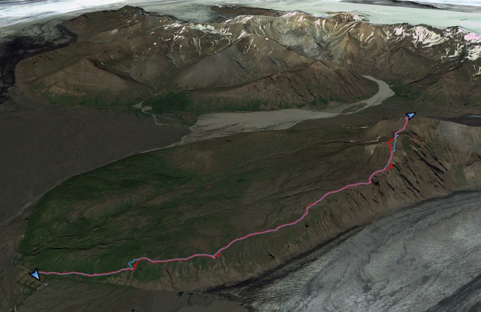
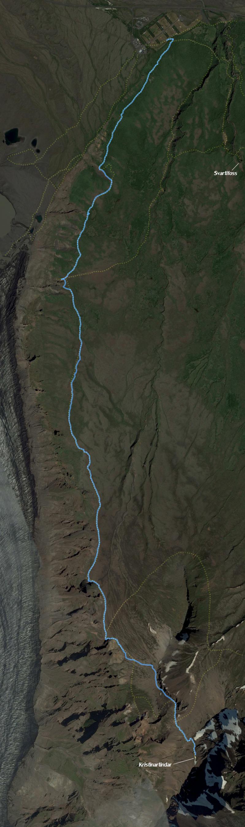
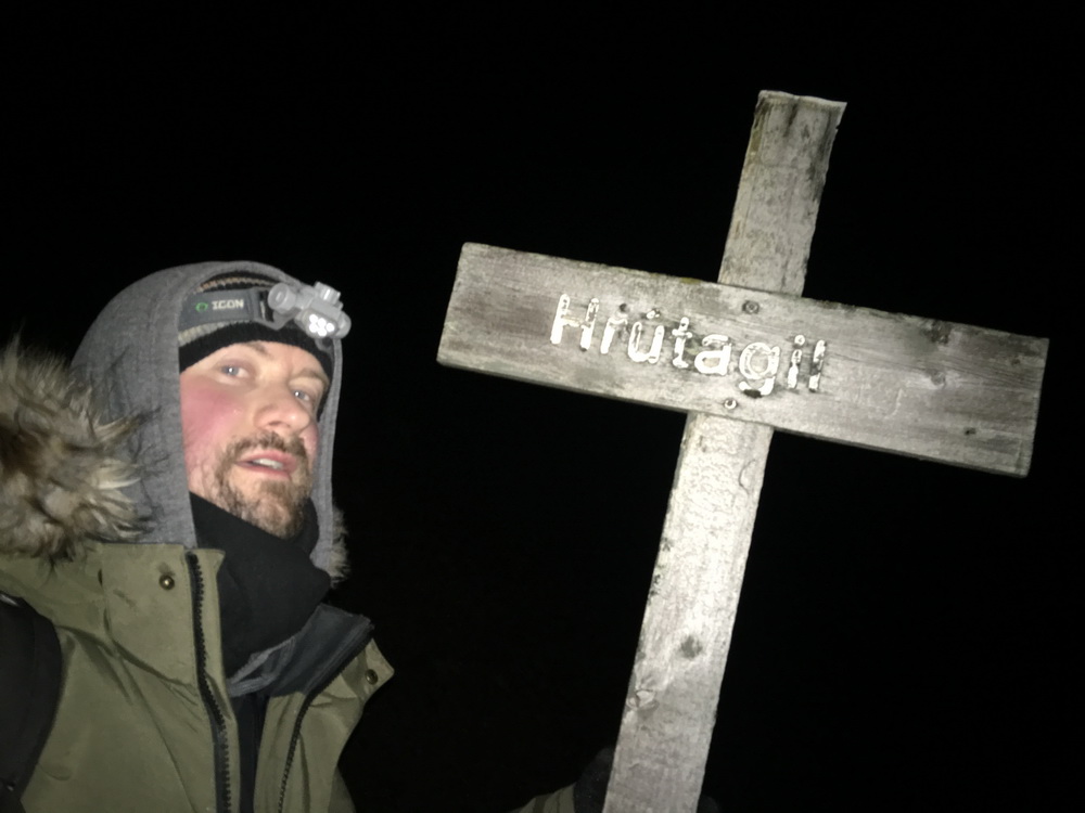
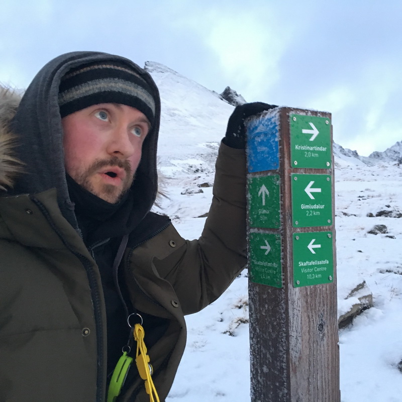
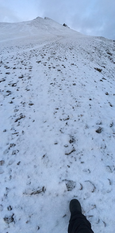
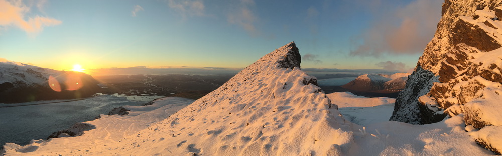
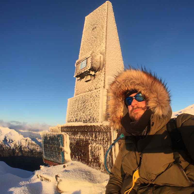
Amongst the various well-marked hiking routes over this region, the route to Kristínartindar itself breaks away from the marked trails, and begins a more difficult winding climb up increasingly angled slopes, until you reach the peak where sits a VHF relay - home also to a visitor's guestbook that you can sign to mark your accomplishment.
This was the mountain that became my mission for the day, my barrier to overcome, and an experience I will never forget.
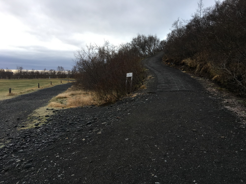
It was a rough night, during which Hrunting was unable to provide a warm, comfortable foundation on which to sleep for more than a half hour or so at a time, giving me at most 3-4 hours of sleep after settling down at midnight. We were parked in a lot around the corner from the big hike trailhead, and I woke up groggy and slightly cramped. I was moving at a snail's pace, shifting things around to change and prepare for the 16km round trip hike.
I'd budgeted time for this hike as one of the larger adventures to undertake during my visit to Iceland, with the intent of finding and logging the geocache placed at the peak, Kristínartindar: The Journey is the Reward - and how true its name was! After researching others' hikes (mostly during warmer months) and forming estimates, I'd planned for up to 5 hours for the round trip hike, including a visit to Svartifoss. This was based on a conservative 4kph average hiking rate, parking very close to Svartifoss, and starting out at 6:00am.
I ended up...
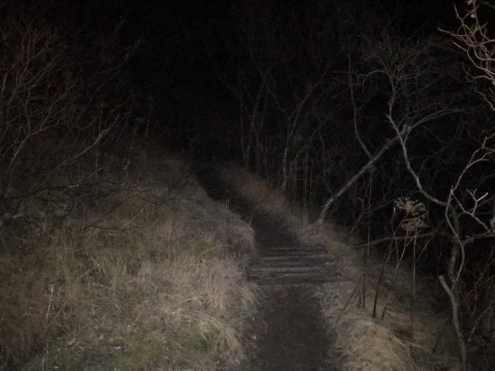
However, most of those hiccups were not apparent when I set out at 7:20am in the morning darkness, excited for what lay in wait. I set my iPhone 4S to record my track log for future reference - location, speed, altitude, distance, time - and my primary iPhone 6S+ would be used for photos, documentation, and quick location updates en route. Both would be secured within my jacket, warm and fully powered for the entire hike. My camel pack was filled with water and another large bottle was packed in my bag. Ready to go!
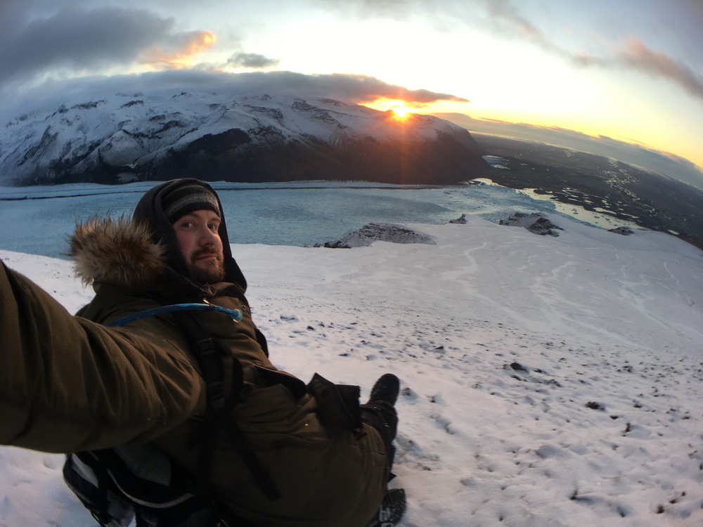
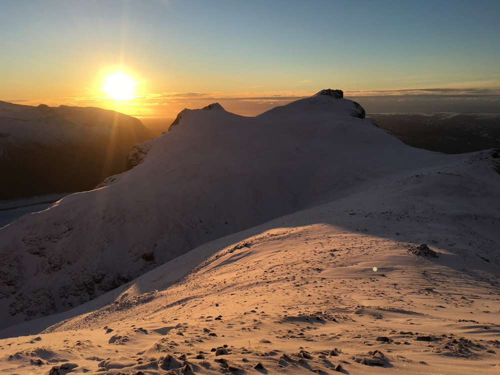
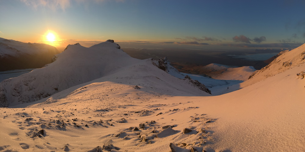
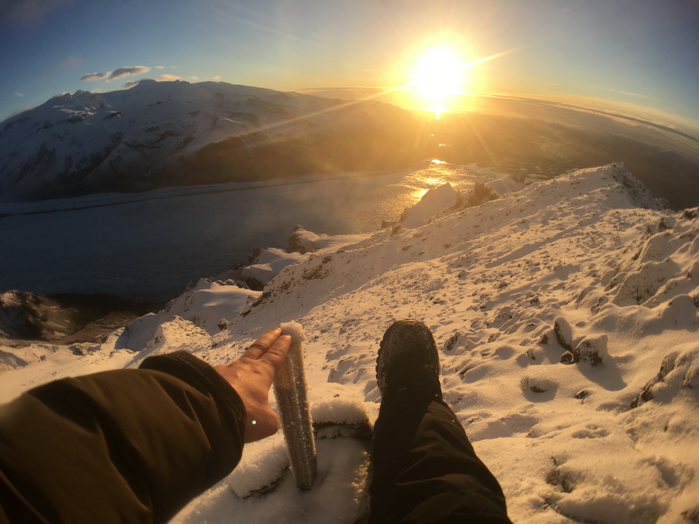
When I first reached the VHF relay that held the guestbook, I removed my glove and laid a hand on the structure. At that moment I was not expecting to become overwhelmed with emotion. This was a first mountain climb of this style I'd done, and during the climb there were points where I felt I could not go on from exhaustion. But I didn't give up; I pushing on, step by step, overcoming the hurdles to reach the goal, and learning, keeping track of things to do better next time.
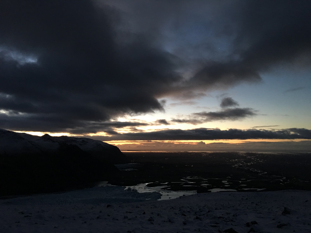
There is no feeling quite like the joy of conquering a personal challenge, and this was quite literally a mountain-top experience. Psalm 121 immediately came to mind when I looked out: "I lift my eyes up to the mountains; where does my help come from? My help comes you - maker of heaven, creator of the Earth." I thanked God for guiding and protecting me (inclement weather was the greatest concern, despite clear skies), and after a few minutes I gathered myself to finalize the accomplishment... There was a book to sign and cache to find!

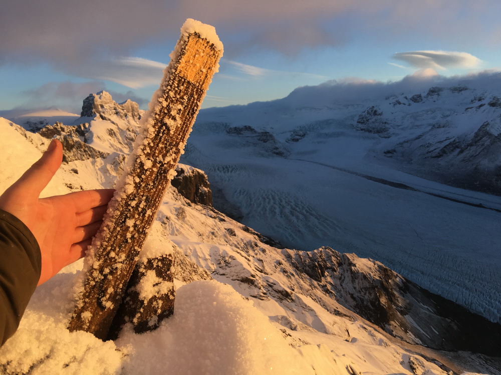
So, where could that guestbook be...? Attached to the side of the relay is a metal box, with a lid and a latch. Yet having release the latch, its lid would not budge. I looked around for a stone to use as a tool - none. There were some larger heavy rocks, but everything was covered by snow-- or rather, ice. I attempted to kick free some smaller stones but the winter would not have it. I tried knocking at the lid with my hand - and drew blood! Well, it seemed I was not meant to sign the guestbook this day. And, while searching for a tool, I also came to realize that the chance of me retrieving the geocache hidden here under a pile of stones covered by snow and ice was slim to none.
Thankfully, the owner of the geocache provided the exception that if you make it to the location but are unable to access its log sheet, he would let you log it as found.
Finally, as I was just about to launch a live Facebook video stream from the peak (there is indeed mobile coverage at that extreme location) my phone, in such a timely manner, decided to shut down from the cold. I knew that the battery wasn't dead, but it needed warmth before it would turn on again.
And that was my signal - time to head home. There were still things to do and places to see in Iceland, and I was still quite conscious of the chance for inclement weather to roll in over me.
With one phone dead, and my camel-pack's water tube effectively filled with ice, I decided I would just take the 'safe' way back, backtracking along the same route I was acquainted with, rather than potentially spending more time following the complete route around as I'd intended. At a few spots I was able to sit, and with a controlled, careful descent, slide down strips of snow and ice where loose shale wasn't peaking through.
In no time I had descended what had taken an eternity to climb, reconnecting with the marked trail and heading back below the snow line into stone, dirt, and vegetation.
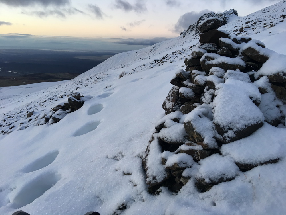
In just over an hour I had escaped the snow and felt like I could touch the visitor's center again. I reached a point of the trail where previously nothing was visible but the black of night and what the headlamp revealed to me. Now, I was passing a large rock pile near the trail. Thinking there might be a tradition connected with it, I found a stone and contributed to the stack, imagining I was now amongst the numerous other adventurers who had completed the same expedition. Silly, perhaps, but it was a milestone to celebrate.
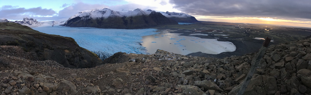
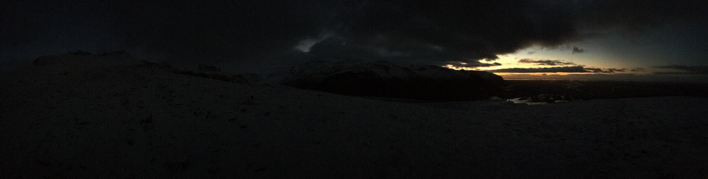
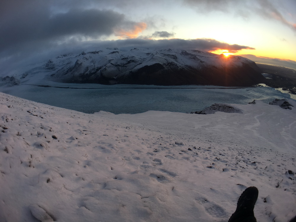
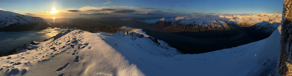
![Panoramic wide angle view of Skaftafellsjökull glacier on the way back to the trailhead.<br/><a href="photos/full/117IMG_4754-skaftafellsjokull-glacier-panorama.JPG" target="_blank">[View large version in a new tab]</a>](photos/thumbs/117IMG_4754-skaftafellsjokull-glacier-panorama.JPG)
Another hour later, legs once again begging for rest, I'd finally made it back to the trailhead. The sun was in its downward arc already, nearing dusk. I'd met and passed a handful of other hikers who had set out on some of the shorter, closer trails, to enjoy what Skaftafell has to offer, but none were on their way to conquer Kristinartindar; definitely not at this time of the day.
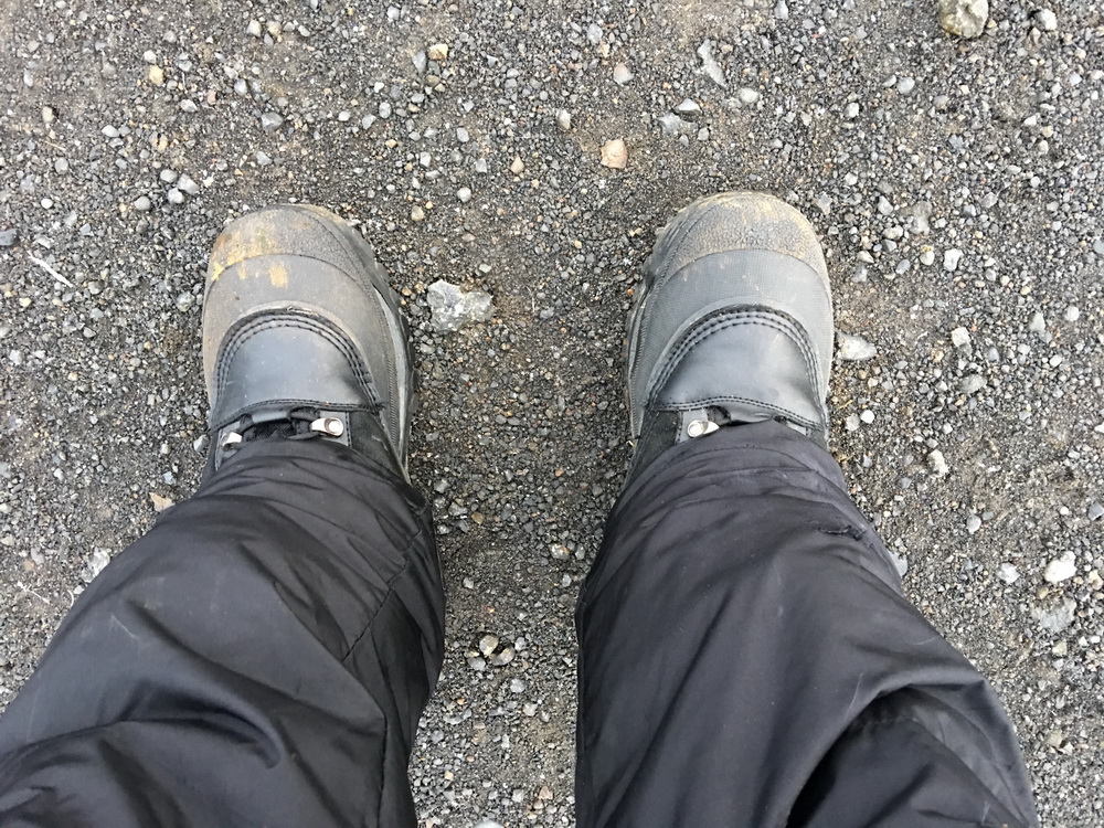
At the trailhead I looked down and thanked my feet for enduring this hardship. They whined, but were quite pleased to be back on flat ground.
I was back at the visitors center which is set to close at 5:00pm. I quickly freshened up in the men's room, getting comfortable, and welcomed some time to relax, enjoying the cafe fare they provided - hot coffee, yogurt, sandwiches, thirst quenching cold drinks. While there, I perused the souvenirs, and chatted with the staff about the park, mountain, and the climb.
I quickly learned that the two stakes posted near the summit of Kristinartindar were placed by the very girl I was talking with, who was happy to know they were still in place and quite appreciated! She'd also completed the ascent 4 times prior, though I didn't find out if those were in winter or summer months. It was a pleasure to meet her, and to shake her hand for those two trail stakes.
After bidding farewell, my feet didn't yet seem to be functioning fully, as I quickly discovered when approaching Hrunting to unload my hiking baggage. I hopped a small stone barrier in the parking lot, but a boot toe caught the bounding wire on the way down, causing my ability to continue and walk away gracefully to disappear in a puff of inevitability. I stumbled and tripped with my bag like a scene from a slapstick sketch, and landed knee first on the pavement tearing a hole straight through two layers of pants and drawing blood. What a finish. A few bystanders nearby looked on - I'd like to think they were watching to find out if I needed assistance, rather than enjoying my misfortune!
Hrunting, on the other hand - Hrunting waited patiently for my return, my faithful companion.
Looking at the track-log kept by the iPhone 4S, which held up the entire hike with plenty of battery to spare, it's fascinating to view the statistics, and recall all the little locations where rests were taken, or stops for photography, or where certain routes provided different terrains - crossing the saddle, or controlled fast descents.
Analysis of the tracklog's record, showing flat distance, speed, and altitude for the full hike. [uTrack]I hope that my experience and all of this data will be useful should you or anyone else consider taking on this excursion to reach the peak of Kristinartindar. It's notable that during warmer summer months the entire mountain is clear of snow (as seen in the satellite imagery on this page), and is quite often ascended by groups of hikers, even with children, who treat it as a day trip adventure.
Should I return to this mountain, I hope to visit during the summer and experience the climb once again, without the harshness of winter cold, extra weight, and treacherous snow and ice cover, with a higher sun and better scheduling, so I can more fully and casually enjoy the entire hike and all the marvelous vistas and sights it provides!
Looking back on this 16km round trip mountain climbed - the journey most certainly was the reward!
| Human wrecks and legacies |
The finding of firsts, and birthday peace |
| Missed Opportunities | Geocaching! |
| |||||||||||||

![Analysis of the tracklog's record, showing flat distance, speed, and altitude for the full hike. <i>[<a href="http://utrack.crempa.net/" target="_blank">uTrack</a>]</i>](images/hike-graphs.png)
